Burnett River flood information
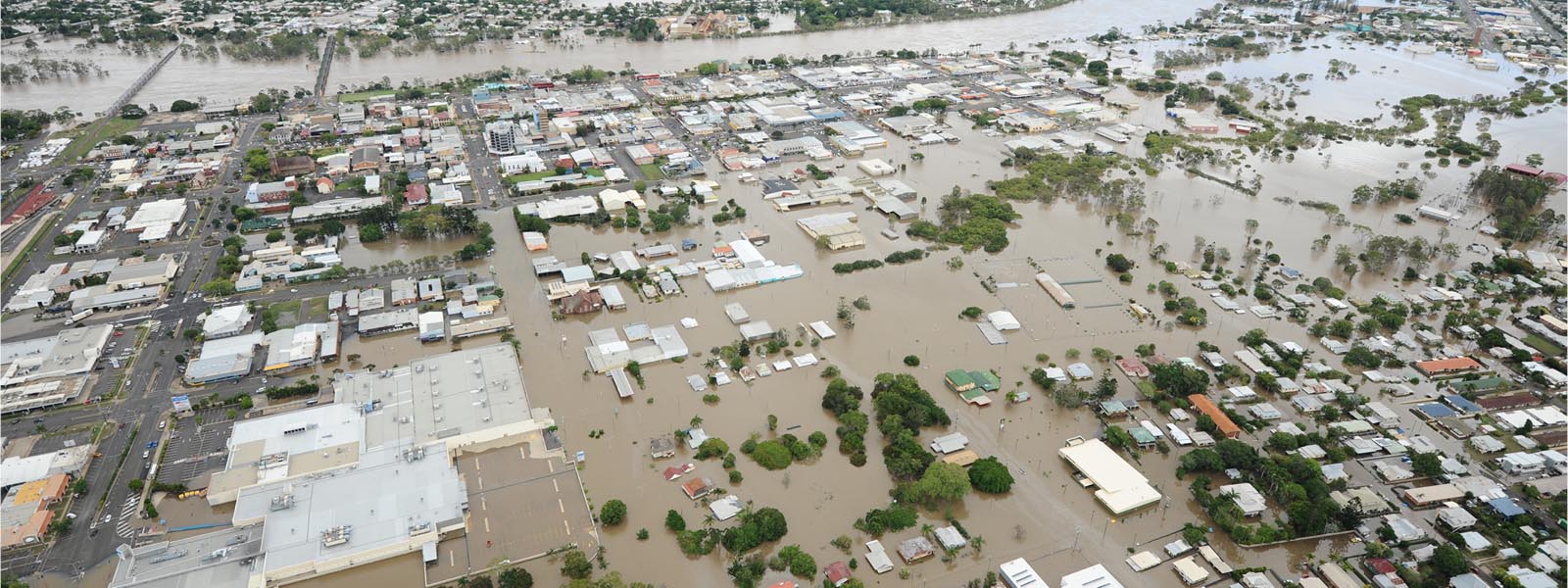
In January 2013, ex-Tropical Cyclone Oswald produced extreme rainfall and flooding across Queensland in tandem with damaging winds including mini-tornados. Some of the most severe impacts centred on the Bundaberg Region with Bundaberg City experiencing its largest flood in recorded history with the Burnett River peaking at 3pm on 29 January 2013 at 9.53 metres (Bundaberg City gauge). North Bundaberg and other low-lying areas of the city were affected along with numerous coastal and rural communities along the Burnett River, Kolan River, Baffle Creek and other creek and river systems across the region.
The height of the flood impact on a property is naturally dependent on its location. The topography (contours) of the Burnett River catchment is varied and so too is the flood level. Flood heights on properties can be identified by utilising Council's flood inundation mapping, flood gauge system or by generating a Flood Planning Control Property Report on Council's interactive mapping.
With the assistance of a Community Reference Group, Council developed an Action Plan for the Burnett River Floodplain. More information on the Burnett River Floodplain Action Plan flood and inundation mapping developed as part of the Burnett River Flood Study can be viewed here.